Export analysis data and results🔗
Use the Export panel to download analysis points, the data in the current plot, or deformation anomaly polygons.
| Export | Format | Contents |
|---|---|---|
| Spatial data | GeoParquet (.parquet) |
Filtered or unfiltered analysis data for the full analysis or a polygon AOI. |
| Current plot | CSV (.csv) |
Data from the plot currently displayed in Iris. |
| Anomalies | GeoJSON (.geojson) |
Deformation anomaly polygons for the analysis. |
Open the Export panel🔗
- Open a site and analysis.
- Click the download arrow icon in the left toolbar to open Export.
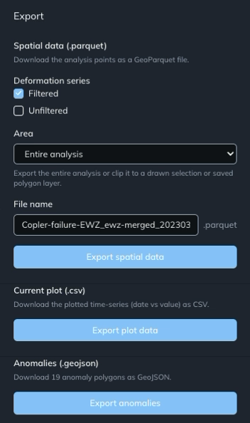
Export spatial data🔗
- Under Spatial data (.parquet), choose the Deformation series to include: Filtered, Unfiltered, or both.
- Open Area and select Entire analysis to export the full analysis, or choose a polygon layer to restrict the export to an AOI.
- Enter your preferred name in File name. The output uses the
.parquetextension shown beside the field. - Click Export spatial data.
- Wait for Iris to prepare the export and complete the download.
The download contains analysis points in GeoParquet format. Open it in GIS software with GeoParquet support. See the GeoParquet software list for compatible tools.
For background on spatial filtering, see Choose a deformation field.
Export a polygon AOI🔗
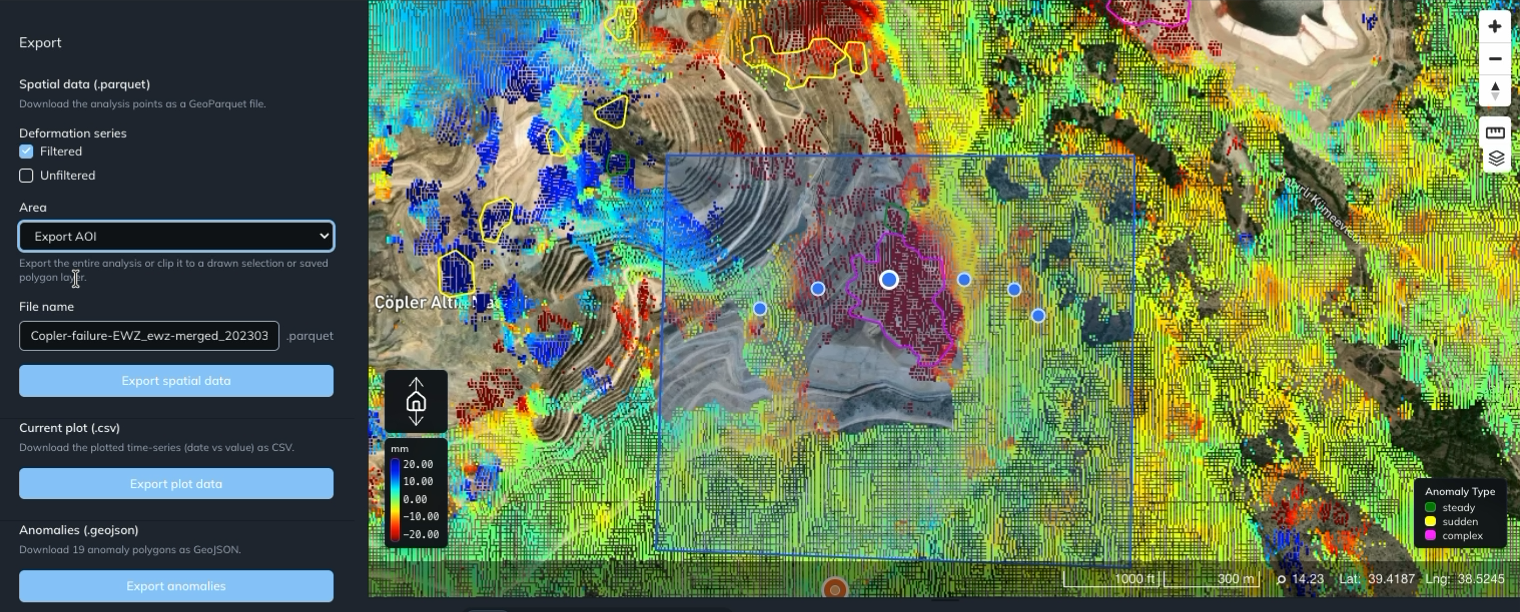
To export a specific area, first draw or import a polygon layer. In the example below, the polygon layer is named Export AOI.
- In Export → Spatial data (.parquet), select the deformation series you want.
- Set Area to Export AOI, or the name of your polygon layer.
- Enter a file name and click Export spatial data.
Iris clips the spatial export to the selected polygon area.
Export the current plot🔗
- Display the plot you want to download, such as a point time series, area average, or transect profile.
- Open Export.
- Under Current plot (.csv), click Export plot data.
Iris downloads the data from the current plot as a CSV file.
Export anomaly polygons🔗
- Open Export for the analysis you want.
- Under Anomalies (.geojson), check the displayed polygon count.
- Click Export anomalies to download the anomaly vectors as GeoJSON.
See Investigate deformation anomalies for the steady, sudden, and complex categories.
Ready to learn more? Our team is available to discuss how EarthDaily's platform can meet your specific needs.
Contact us